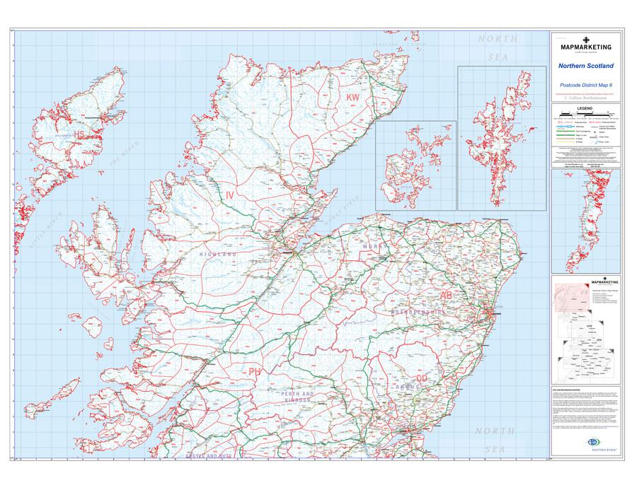


This postcode district map displays the complete first half of the Postcode (or Outward Code) for Northern Scotland includes Uist, Orkney and Shetland. This map covers the following area:
North: John O’Groats
South: St Andrews
East: Peterhead
West: Barra
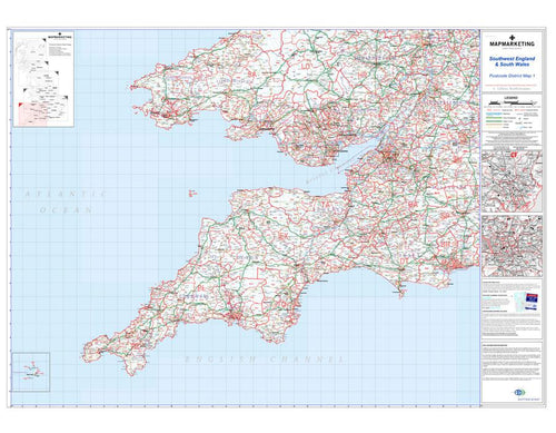
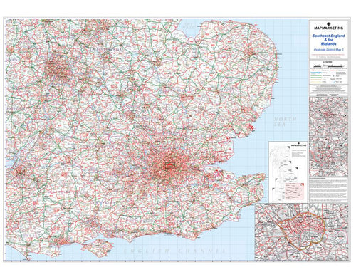
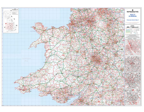
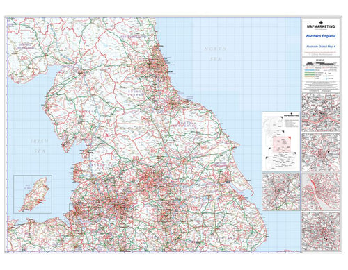
This District map presents the complete first half of the Postcode (or Outward Code) and is the sixth of six pre-defined sheets that covers Britain at a scale of an inch to 5 miles. The District maps include all of the Postcode changes from the most recent Royal Mail Postcode Update. The Area and District boundaries appear prominently in red with County and Unitary Authority boundaries displayed in purple. The map base shows motorways, primary and ‘A’ and ‘B’ roads and features conurbation shapes highlighting major towns and cities.
This postcode map provides detailed map insets of the islands of Uist, Orkney and Shetland providing comprehensive detail of the three cities and the postcode districts they hold.
Specifications:Size: 91 x 127 cm (35 x 50 inches)
Scale: 1:320,000
Northern Scotland (Uist, Orkney and Shetland) Postcode Map - District Map 6

Size: 91 x 127 cm (35 x 50 inches)
Product Code: D6-AL
This postcode district map displays the complete first half of the Postcode (or Outward Code) for Northern Scotland includes Uist, Orkney and Shetland. This map covers the following area:
North: John O’Groats
South: St Andrews
East: Peterhead
West: Barra
This District map presents the complete first half of the Postcode (or Outward Code) and is the sixth of six pre-defined sheets that covers Britain at a scale of an inch to 5 miles. The District maps include all of the Postcode changes from the most recent Royal Mail Postcode Update. The Area and District boundaries appear prominently in red with County and Unitary Authority boundaries displayed in purple. The map base shows motorways, primary and ‘A’ and ‘B’ roads and features conurbation shapes highlighting major towns and cities.
This postcode map provides detailed map insets of the islands of Uist, Orkney and Shetland providing comprehensive detail of the three cities and the postcode districts they hold.
Specifications:Size: 91 x 127 cm (35 x 50 inches)
Scale: 1:320,000
REVIEWS