


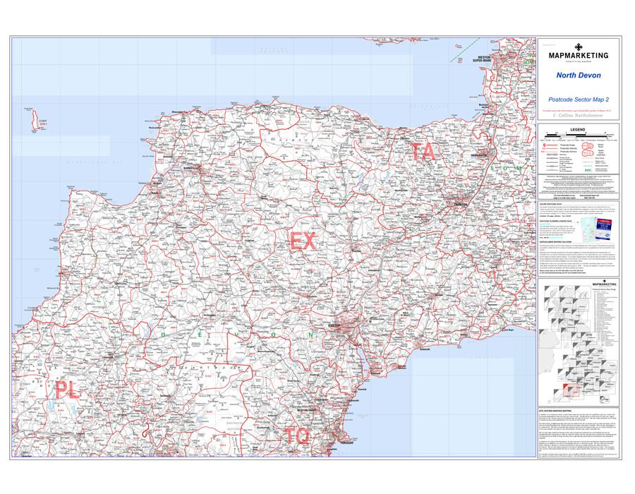


Postcode Map of North Devon including Torquay and Taunton with coverage from Weston-Super-Mare to Ilminster to Lundy.
Sector Sheet 2: North Devon. This large postcode sector map is the second of 37 pre-defined map sheets that cover the UK. This map displays the whole first part of the postcode and the first number of the second part of your postcode, or Inward Code, at a scale of an inch to 2.4 miles.
The North Devon Postcode Map includes the seaside towns such as Torquay, Taunton and more - the map geographical coverage includes:
North: Weston-Super-Mare
South: Torquay
East: Ilminster
West: Lundy
This Sector map includes all of the postcode changes in the most recent Royal Mail Postcode Update. Area, District and Sector boundaries and numbers/letters are shown in red with County and Unitary Authority boundaries presented in green. The map base shows motorways, primary, ‘A’ and down to unclassified roads with conurbation shapes and city plan insets showing street level detail for major cities, making it ideal for business use for logistics, marketing and even sales.
Specifications:
Size: 73 x 107 cm (29 x 42 inches)
Scale: 1:150 000 (1 inch to 2.4 miles)
North Devon Postcode Wall Map - Sector Map 2

Size: 73 x 107 cm (29 x 42 inches)
Product Code: S2P
Postcode Map of North Devon including Torquay and Taunton with coverage from Weston-Super-Mare to Ilminster to Lundy.
Sector Sheet 2: North Devon. This large postcode sector map is the second of 37 pre-defined map sheets that cover the UK. This map displays the whole first part of the postcode and the first number of the second part of your postcode, or Inward Code, at a scale of an inch to 2.4 miles.
The North Devon Postcode Map includes the seaside towns such as Torquay, Taunton and more - the map geographical coverage includes:
North: Weston-Super-Mare
South: Torquay
East: Ilminster
West: Lundy
This Sector map includes all of the postcode changes in the most recent Royal Mail Postcode Update. Area, District and Sector boundaries and numbers/letters are shown in red with County and Unitary Authority boundaries presented in green. The map base shows motorways, primary, ‘A’ and down to unclassified roads with conurbation shapes and city plan insets showing street level detail for major cities, making it ideal for business use for logistics, marketing and even sales.
Specifications:
Size: 73 x 107 cm (29 x 42 inches)
Scale: 1:150 000 (1 inch to 2.4 miles)
REVIEWS


