
An Archive of Ordnance Survey maps centred on your home. Save 20% Off Whilst Stocks Last!
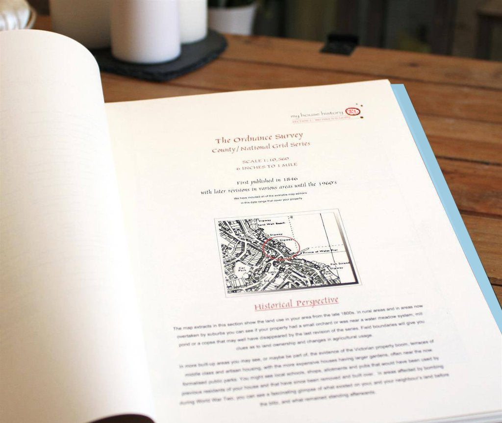
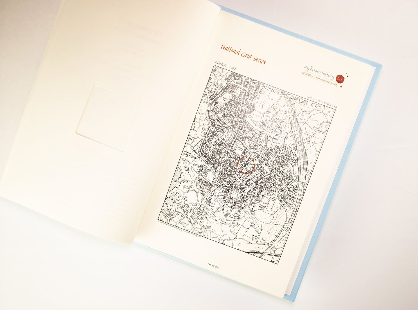
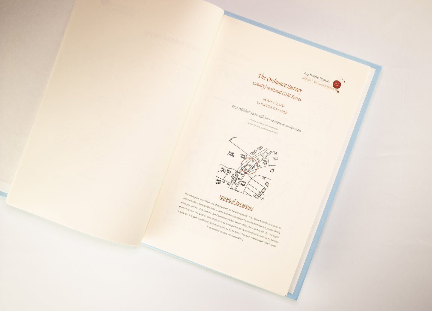
My House History is a fascinating made-to-order document, presenting historical Ordnance Survey map extracts centred on your home or area of choice. The OS Mapping is taken from individual surveys of your area which commenced circa 1841 through to the 1960s. After the initial survey, the mapping for every county in England and Wales was further revised between three and five times during this period, thus your personal Portfolio will contain multiple extracts illustrating those survey editions. A typical Portfolio contains seven historical map extracts at two scales (1:2,500 & 1:10,560).
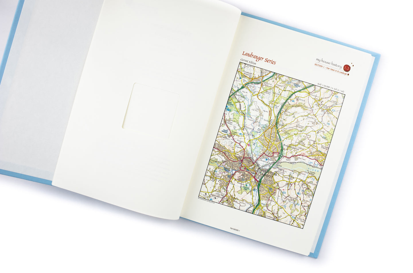
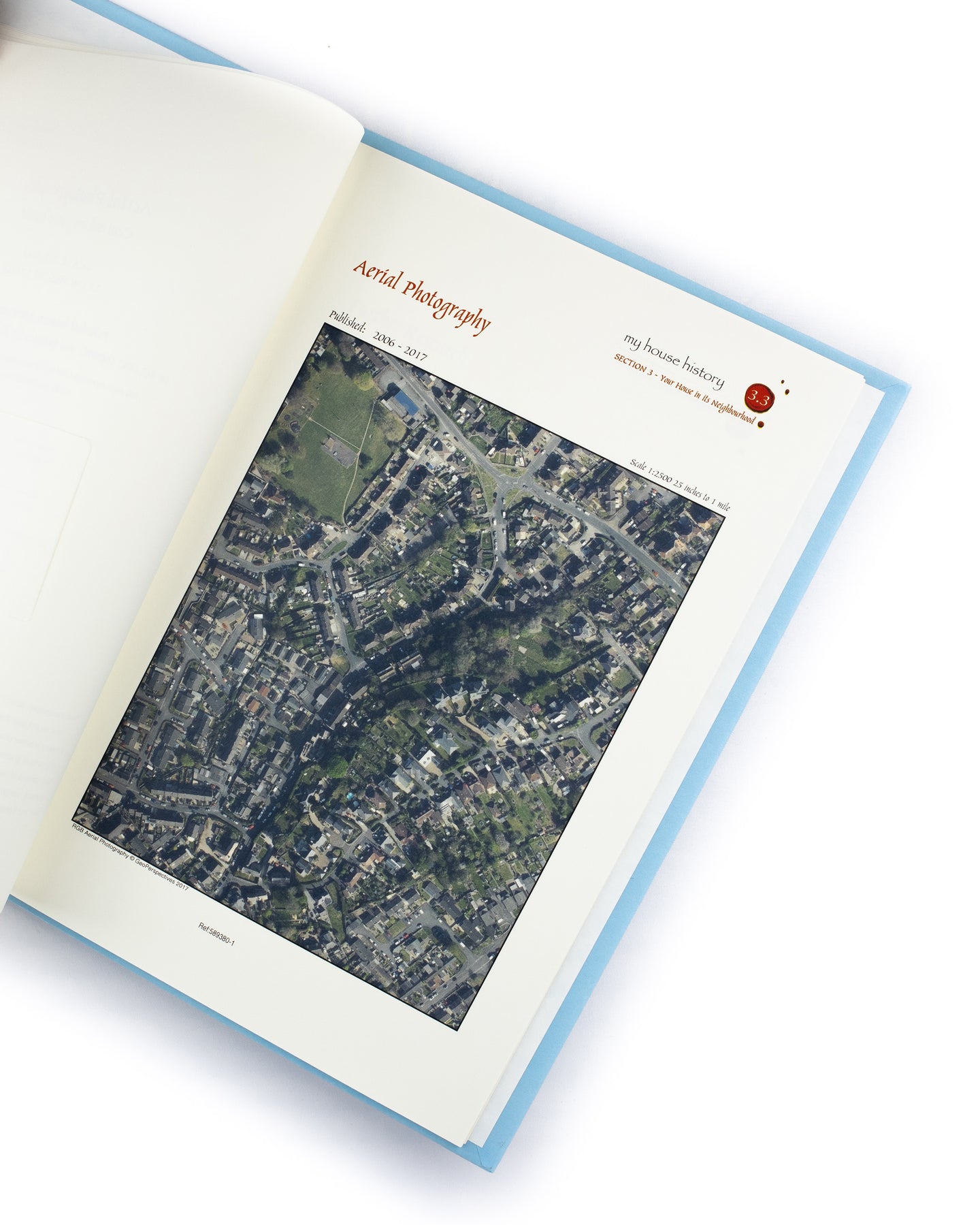
In addition to the above historical mapping (which comes complete with a legend to aid interpretation), your Portfolio will also contain a contemporary full colour aerial photograph (scale 1:2,500) and a complimentary full colour extract taken from the current Ordnance Survey map base presented at 1:50,000 scale (worth £5.95). Again, both extracts will be centred on your Portfolio's location.
Your personalised Portfolio provides a unique dossier tracing the geographical changes over 150 years surrounding your home, property and local community. It also contains expert advice on how to investigate further the history of your home.
Your My House History Portfolio is presented in a handsome and high quality storage case that features a handy internal device that allow for safe removal and replacement of pages without damage. This allows you to insert additional pages.
Available for England and Wales only
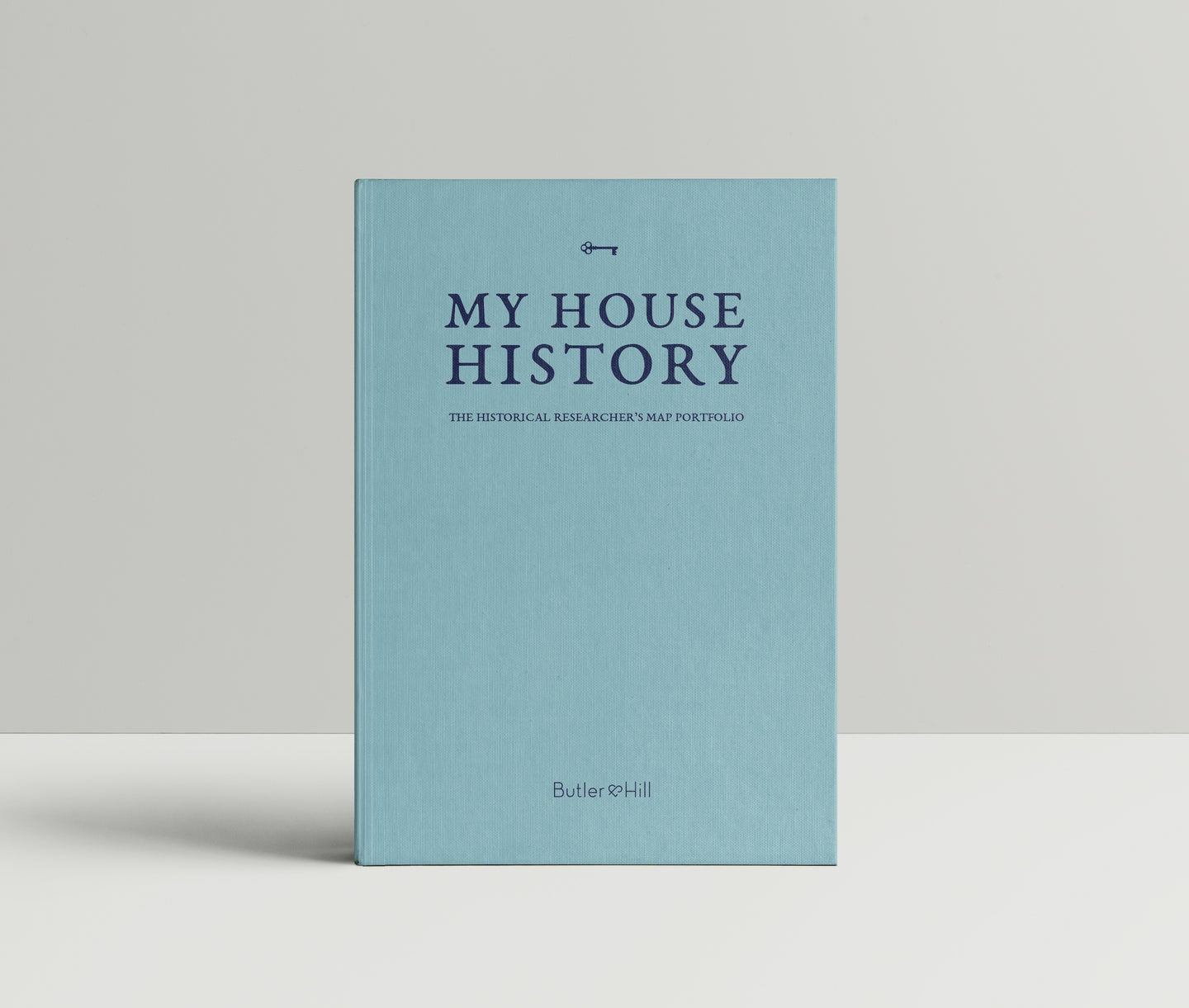
My House History - A Personalised Map Portfolio

Product Code: PF1
An Archive of Ordnance Survey maps centred on your home. Save 20% Off Whilst Stocks Last!
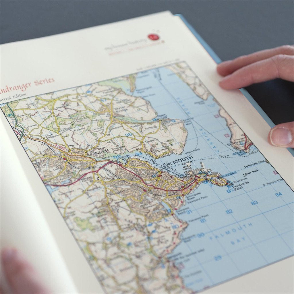
My House History is a fascinating made-to-order document, presenting historical Ordnance Survey map extracts centred on your home or area of choice. The OS Mapping is taken from individual surveys of your area which commenced circa 1841 through to the 1960s. After the initial survey, the mapping for every county in England and Wales was further revised between three and five times during this period, thus your personal Portfolio will contain multiple extracts illustrating those survey editions. A typical Portfolio contains seven historical map extracts at two scales (1:2,500 & 1:10,560).
In addition to the above historical mapping (which comes complete with a legend to aid interpretation), your Portfolio will also contain a contemporary full colour aerial photograph (scale 1:2,500) and a complimentary full colour extract taken from the current Ordnance Survey map base presented at 1:50,000 scale (worth £5.95). Again, both extracts will be centred on your Portfolio's location.
Your personalised Portfolio provides a unique dossier tracing the geographical changes over 150 years surrounding your home, property and local community. It also contains expert advice on how to investigate further the history of your home.
Your My House History Portfolio is presented in a handsome and high quality storage case that features a handy internal device that allow for safe removal and replacement of pages without damage. This allows you to insert additional pages.
Available for England and Wales only
REVIEWS