

Mapping Bases
We currently hold a range of 11 different GB mapping bases, which have been carefully selected to offer you maximum scale flexibility and a choice of design options. The six most commonly used bases are shown below and all feature:
- motorway, ‘A’ & ‘B’ roads
- cities & towns
- county & unitary authority boundaries
- a range of optional detailed city street plan insets (where applicable).
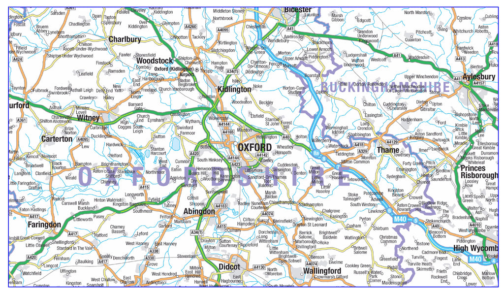
Map Marketing GB Planners Base
Its crisp, clear & uncluttered design makes this an ideal multi-purpose base suitable for covering large regional areas (e.g. South West England). An excellent base for mapping out strategic planning areas or providing a wider overview of multiple sales territories etc. The simple map style lends itself particularly well to the addition of extra layers of information e.g. Postcode or Health Authority boundaries. If desired the map base itself can be rendered greyscale (black and white) while certain information layers can be kept in colour in order to really make them stand out.
Bartholomew GB Routes & Counties Base
An excellent, comprehensive base map with a high level of colourful, easy-to-read detail. Equally effective as a stand alone map or with additional layers of information overlaid. Shows extra layers of smaller roads, towns & villages that don’t appear on the Map Marketing base. Well designed for use as a route planning tool, this base works equally well for covering slightly smaller areas, for example two or three individual counties. An ideal base for site-centred Postcode District maps.

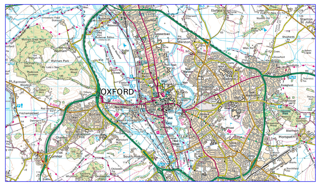
Ordnance Survey Landranger® Base
This popular map base from Britain’s National Mapping Agency features a high level of detail particularly suited to mapping at a local scale. The base features full street plan layouts for all cities, towns & villages (without street names) as well as a wealth of information including (amongst others) roads, railways, churches, contours, tourist information & public rights of way all on the backdrop of the National Grid layout. The Ordnance Survey update this map base every year, so you can be sure your map contains the latest information.
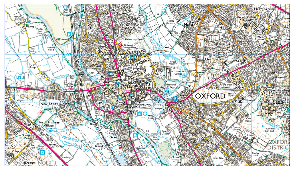
Ordnance Survey Explorer® Base
Even more detailed than the Landranger mapping, ideally suited for more rural areas. This is the largest scale mapping available that shows public rights of way, access land and parish boundaries. The Explorer base features building shape outlines for larger buildings on top of full street plan layouts for all cities, towns and villages (without street names). The fantastic level of detail includes (amongst others) roads, railways, churches, schools, contours, field boundaries and tourist information all on the backdrop of the National Grid layout. We receive mapping updates from the Ordnance Survey every year, so you can be sure your map contains the latest information available.
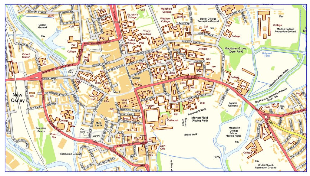
Ordnance Survey Streetview Mapping
This extensive map base provides detailed street level coverage of the whole of Great Britain. Urban areas, railways and road route numbers are also displayed. This map base is designed for covering small geographical areas e.g. medium sized towns and therefore is excellent for local delivery services.
Bartholomew Greater London Street Level Base
Full detailed named street level mapping within the M25, this is the perfect option for mapping in and around the Capital. Attractive as well has highly functional this map base shows all railway & tube stations, hospitals, schools & Borough boundaries. Postcode boundaries at Area, District & Sector level are a particularly useful and popular optional addition to this map base. We can now add the Mayor of London’s Congestion Charge Zone boundary to this map base to help you avoid those tolls.
