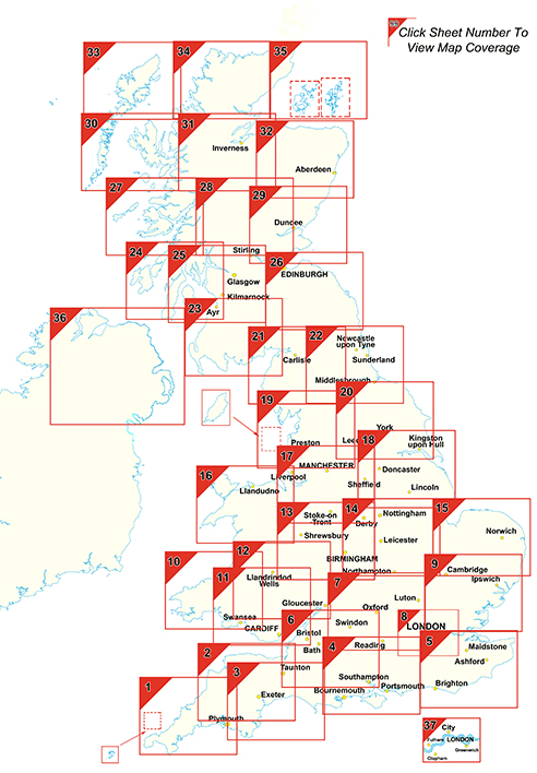
Postcode Sector Maps - a set of 37 maps showing Postcode Sectors
This is one of 37 pre-defined map sheets that covers the UK at Sector level displaying all of the first part of the postcode and the first number of the second part, or Inward Code, at a scale of an inch to 2.4 miles. This Sector map includes all of the postcode changes in the most recent Royal Mail Postcode Update. Area, District and Sector boundaries and numbers/letters are shown in red with County and Unitary Authority boundaries presented in green. The map base shows motorways, primary, ‘A’ and down to unclassified roads with conurbation shapes and city plan insets showing street level detail for major cities.
CUSTOMISED POSTCODE MAPS
Can't find what you're looking for? Our custom mapping department can create affordable, unique site-centred maps covering just the area you need. Choose from a wide range of map styles, scales, data overlays and finishing options. Click here for more information or get a customised map quote.
Get a quotePostcode Sector Map Range
How Sector Postcodes Work
Postcode Sectors (9,000 in total) which are denoted by the first number of the second part of the Postcode. This half of the Postcode is called the Inward Code.
Example: SW6 3
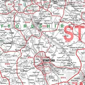
Sector Map Detail
Sheet Details
Size 73 x 107 cm (29 x 42 inches)
Scale 1:150 000 (2.4 miles to 1 inch)*
*Except maps 8, 36 and 37.
Click the sheet number on the key map to view each map
Postcode Sector Key Map