

Postcode Area Maps - with boundaries for the whole of the UK
Postcode Area Maps - with boundaries for the whole of the UK
Excellent as a business planning map showing Postcode Area boundaries, our range of postcode maps show the most up-to-date County and Unitary Authority boundary information for the whole of the UK. This includes the new Unitary Authorities which came into existence in April 2009. Clearly shown on a black-and-white base map (with national parks highlighted in pale green), the Postcode Area boundaries and their corresponding letters are displayed in red with County and Unitary Authority boundaries shown in dark green.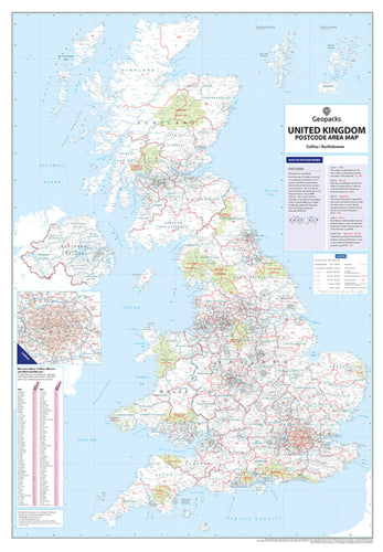
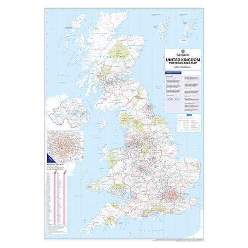
This layout is an ideal way to segregate post code areas for business planning whether for marketing, logistics or sales purposes - each postcode area is clearly distinguished from the others.