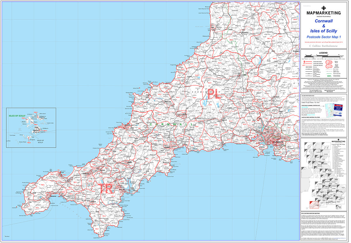

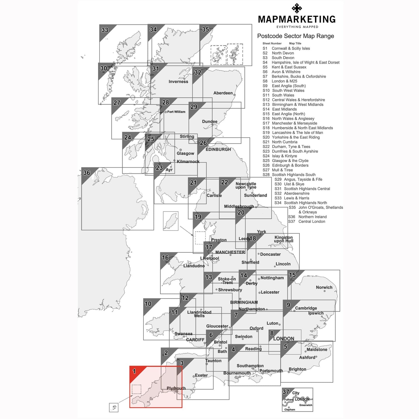
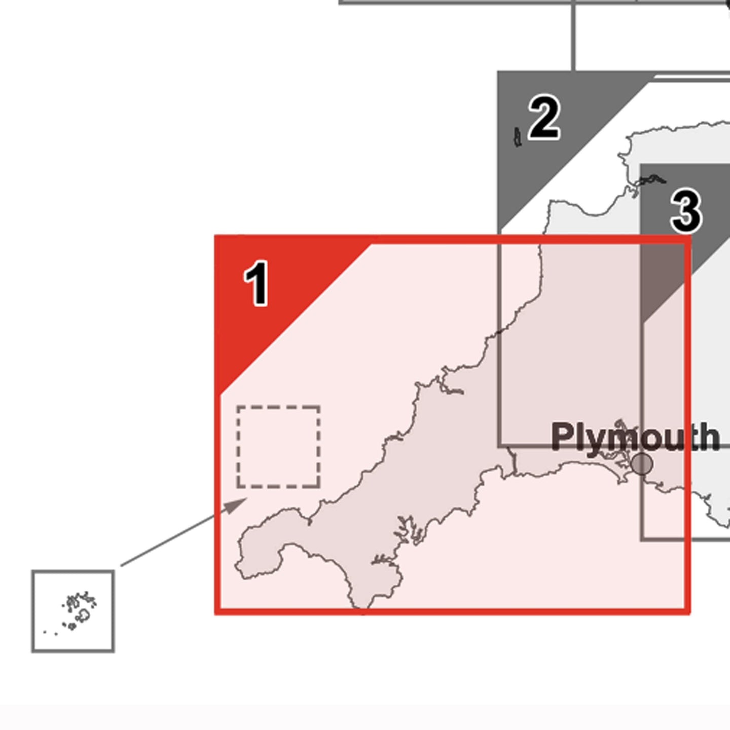

Cornwall and Scilly Isles - Postcode Wall Map
Cornwall & the Isles of Scilly is Map No.1 in our range of Postcode Sector Maps. With coverage from Bradworthy to the Lizard, from Tavistock to Land's End, the Scilly Isles are shown as an inset.
Dimensions:
- Size: 73 x 107 cm (29 x 42 inches)
- Scale: 1:150 000 (1 inch to 2.4 miles)
This large Postcode Sector Map displays all of the first part of the postcode and the first number of the second part, or Inward Code of the Cornwall and the Scilly Isles in the UK at a scale of an inch to 2.4 miles. The map area covers:
North: Bradworthy
South: The Lizard
East: Tavistock
West: Land's End
Cornwall and Scilly Isles Postcode Wall Map - Sector Map 1

Product Code: S1P
Cornwall and Scilly Isles - Postcode Wall Map
Cornwall & the Isles of Scilly is Map No.1 in our range of Postcode Sector Maps. With coverage from Bradworthy to the Lizard, from Tavistock to Land's End, the Scilly Isles are shown as an inset.
Dimensions:
- Size: 73 x 107 cm (29 x 42 inches)
- Scale: 1:150 000 (1 inch to 2.4 miles)
This large Postcode Sector Map displays all of the first part of the postcode and the first number of the second part, or Inward Code of the Cornwall and the Scilly Isles in the UK at a scale of an inch to 2.4 miles. The map area covers:
North: Bradworthy
South: The Lizard
East: Tavistock
West: Land's End
REVIEWS