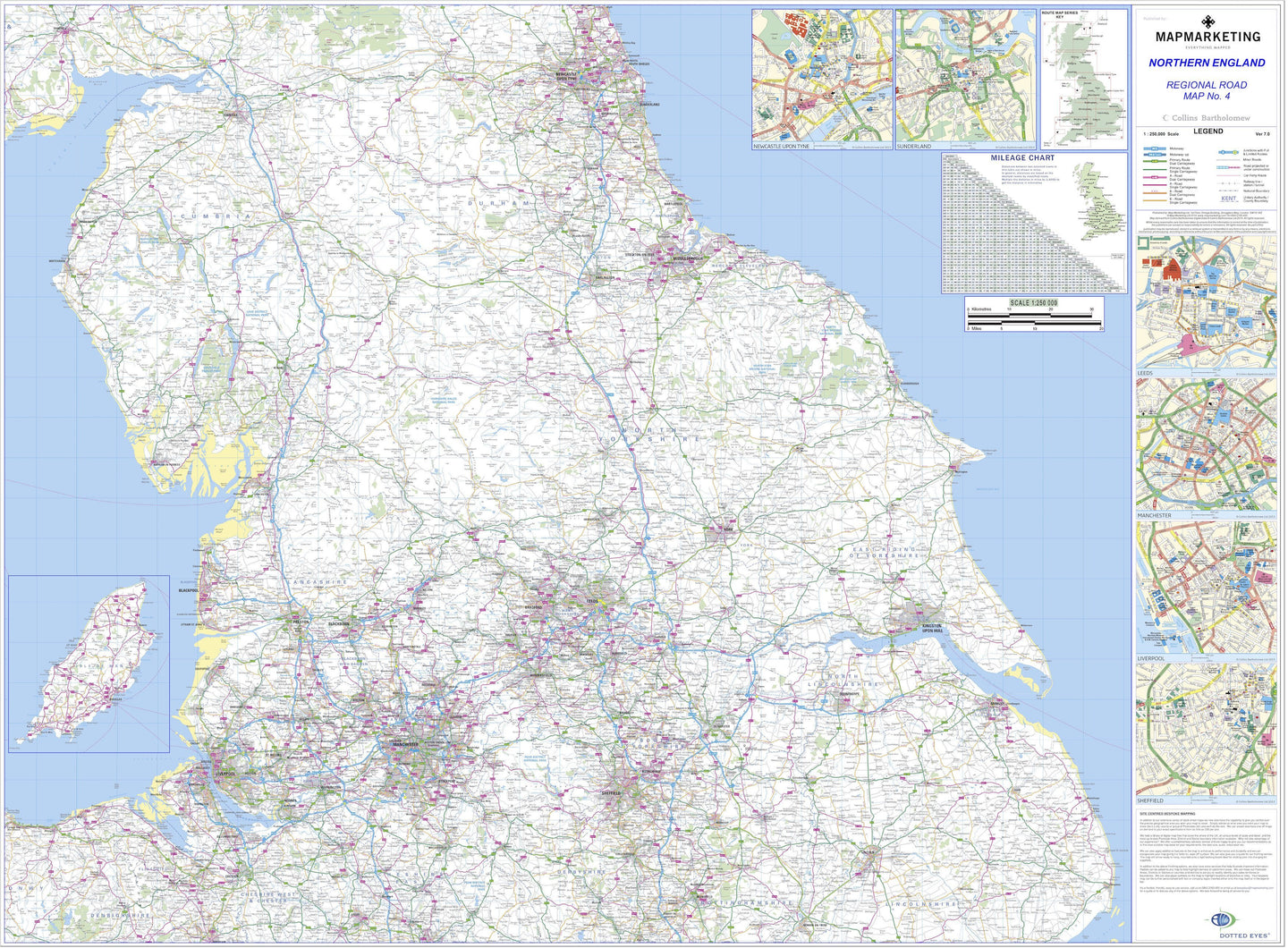
Northern England Regional Road Map - includes Newcastle, Sunderland, Leeds, Manchester, Sheffield, Liverpool.
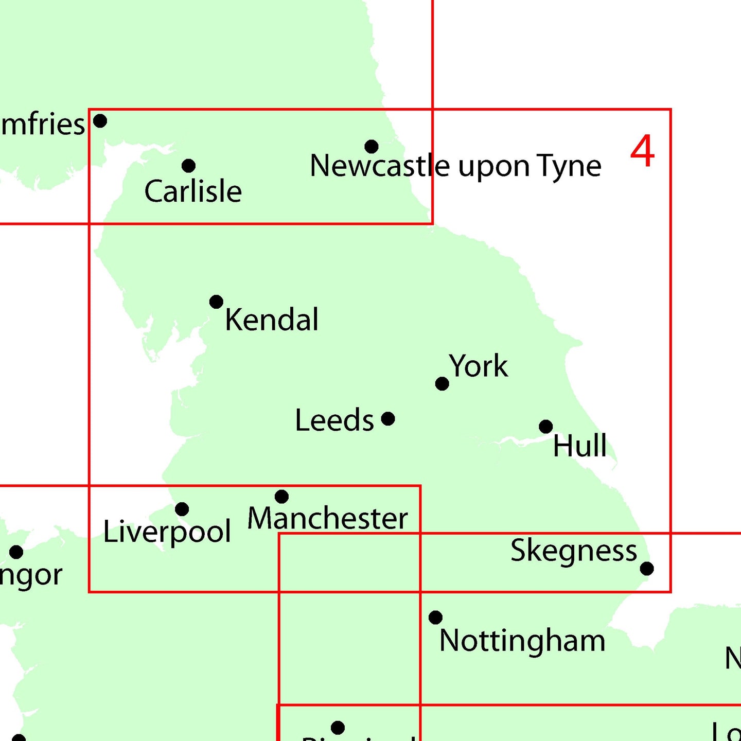
This series of regional road maps is published exclusively by Map Marketing. Map No 4 focuses on Northern England and covers Newcastle, Sunderland, Leeds, Manchester, Sheffield and Liverpool.
Road Sheet 4: Northern England
Size: 96 x 130 cm (38 x 51 inches)
Scale: 1:250 000 (3.94 miles: 1 inch)
Regional Insets: Isle of Man
City Plans: Newcastle, Sunderland, Leeds, Manchester, Sheffield, Liverpool
Geographical Coverage Guide:
North: Dumfries
South: Newark-on-Trent
East: Skegness
West: Colwyn Bay
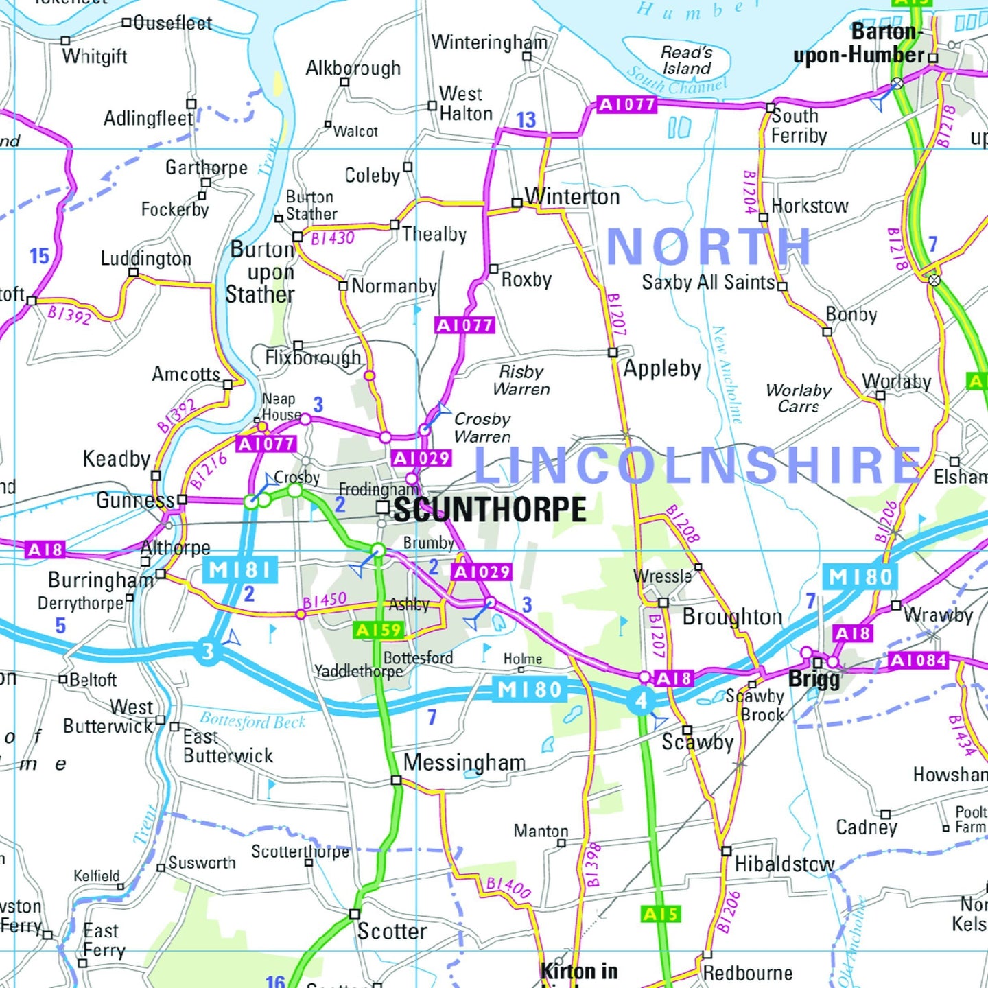
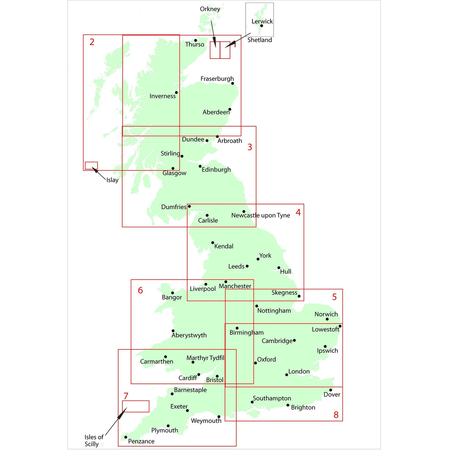
This is one map in an eight-sheet map set, updated annually using the latest mapping data from Collins Bartholomew to cover the whole of Great Britain in considerable detail. Most roads are shown with motorways, trunk roads, dual carriageways, main and secondary routes all prominently depicted in an easy to read style. A helpful mileage guide is included along with city centre street plans for the major cities on each map. Ideal for regional route planning, these maps also feature helpful information such as railways, airports, county boundaries and rivers.
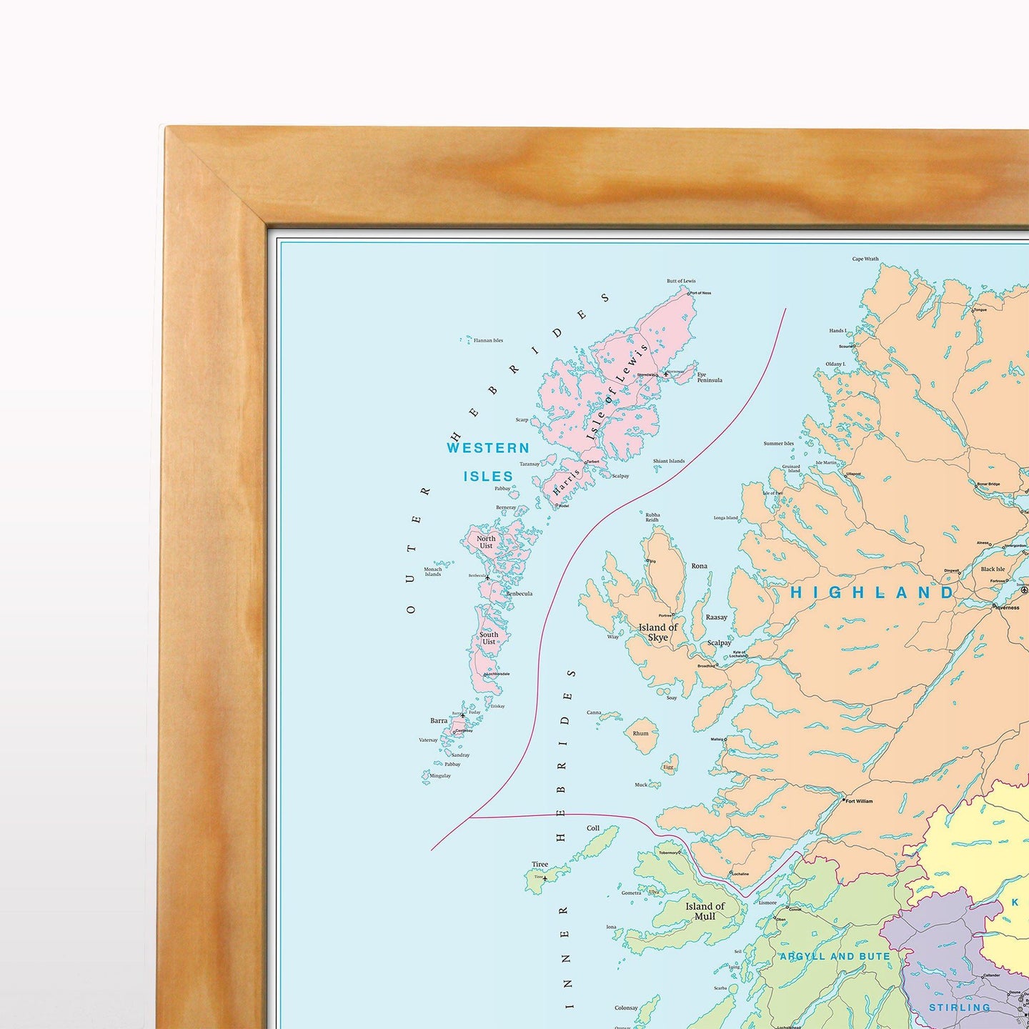
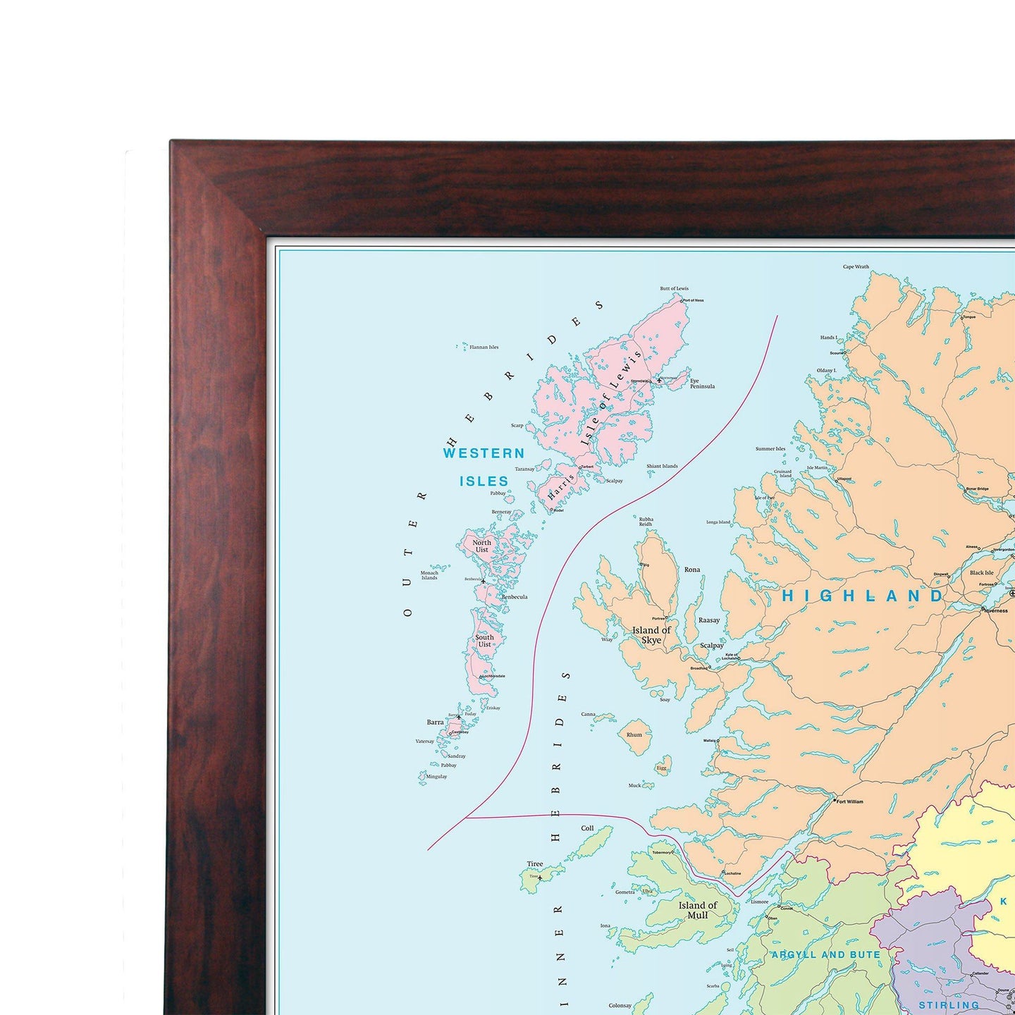
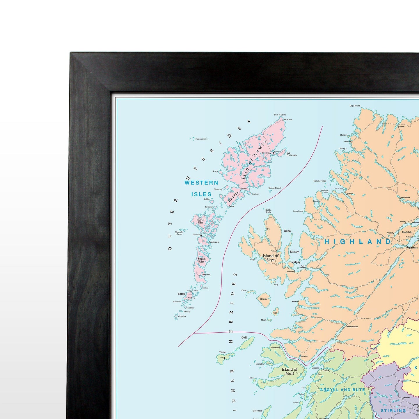
This map is permanently bonded between two sheets of tough, flexible, crystal-clear plastic. This finish allows you to “write on, wipe off” with dry or wet wipe pens. This map is also available laminated and framed in either superb satin-finish aluminium or light, black or dark wood supplied ready to display.
Northern England Regional Road Map - includes Newcastle, Sunderland, Leeds, Manchester, Sheffield, Liverpool.
This series of regional road maps is published exclusively by Map Marketing. Map No 4 focuses on Northern England and covers Newcastle, Sunderland, Leeds, Manchester, Sheffield and Liverpool.
Road Sheet 4: Northern England
Size: 96 x 130 cm (38 x 51 inches)
Scale: 1:250 000 (3.94 miles: 1 inch)
Regional Insets: Isle of Man
City Plans: Newcastle, Sunderland, Leeds, Manchester, Sheffield, Liverpool
Geographical Coverage Guide:
North: Dumfries
South: Newark-on-Trent
East: Skegness
West: Colwyn Bay
This is one map in an eight-sheet map set, updated annually using the latest mapping data from Collins Bartholomew to cover the whole of Great Britain in considerable detail. Most roads are shown with motorways, trunk roads, dual carriageways, main and secondary routes all prominently depicted in an easy to read style. A helpful mileage guide is included along with city centre street plans for the major cities on each map. Ideal for regional route planning, these maps also feature helpful information such as railways, airports, county boundaries and rivers.
This map is permanently bonded between two sheets of tough, flexible, crystal-clear plastic. This finish allows you to “write on, wipe off” with dry or wet wipe pens. This map is also available laminated and framed in either superb satin-finish aluminium or light, black or dark wood supplied ready to display.