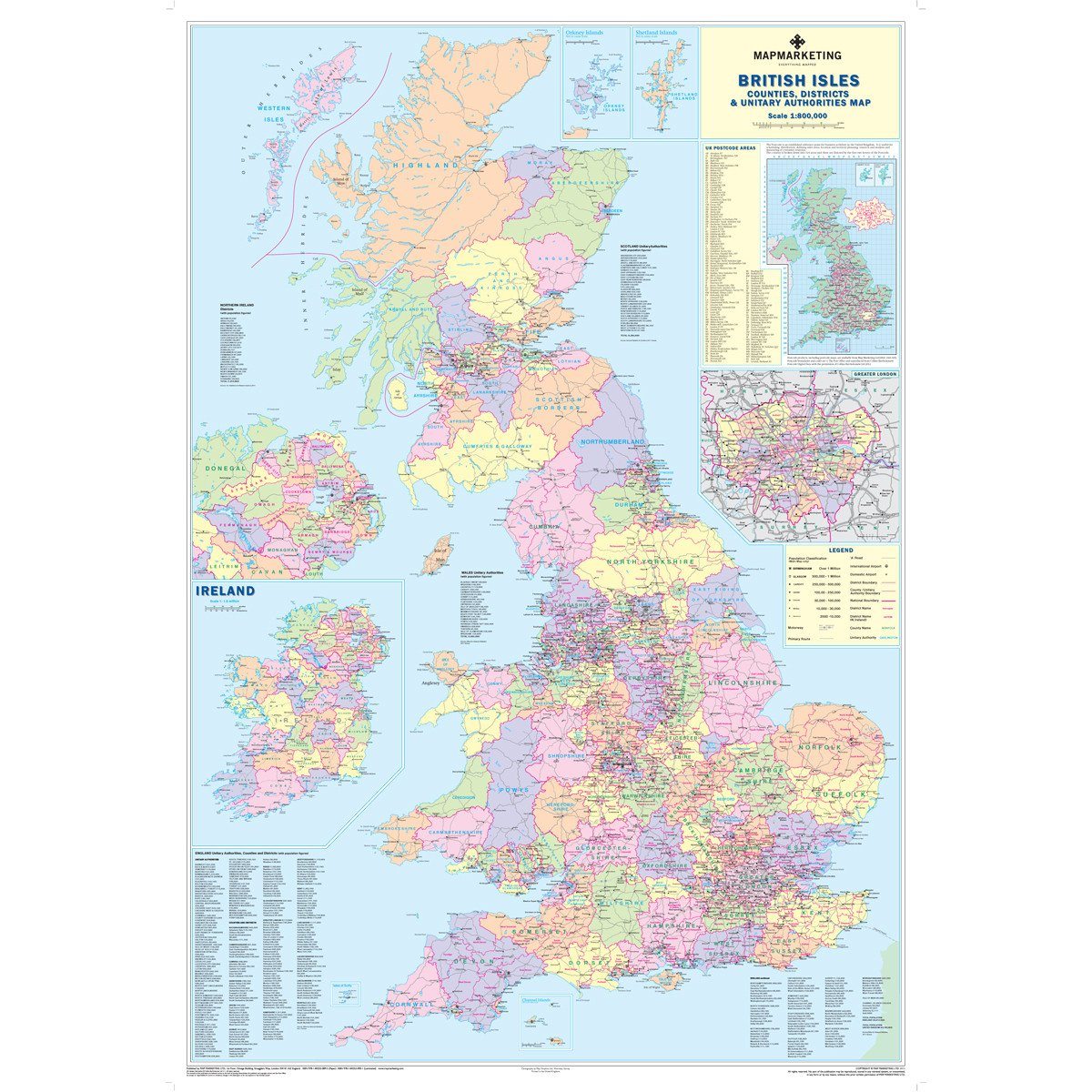
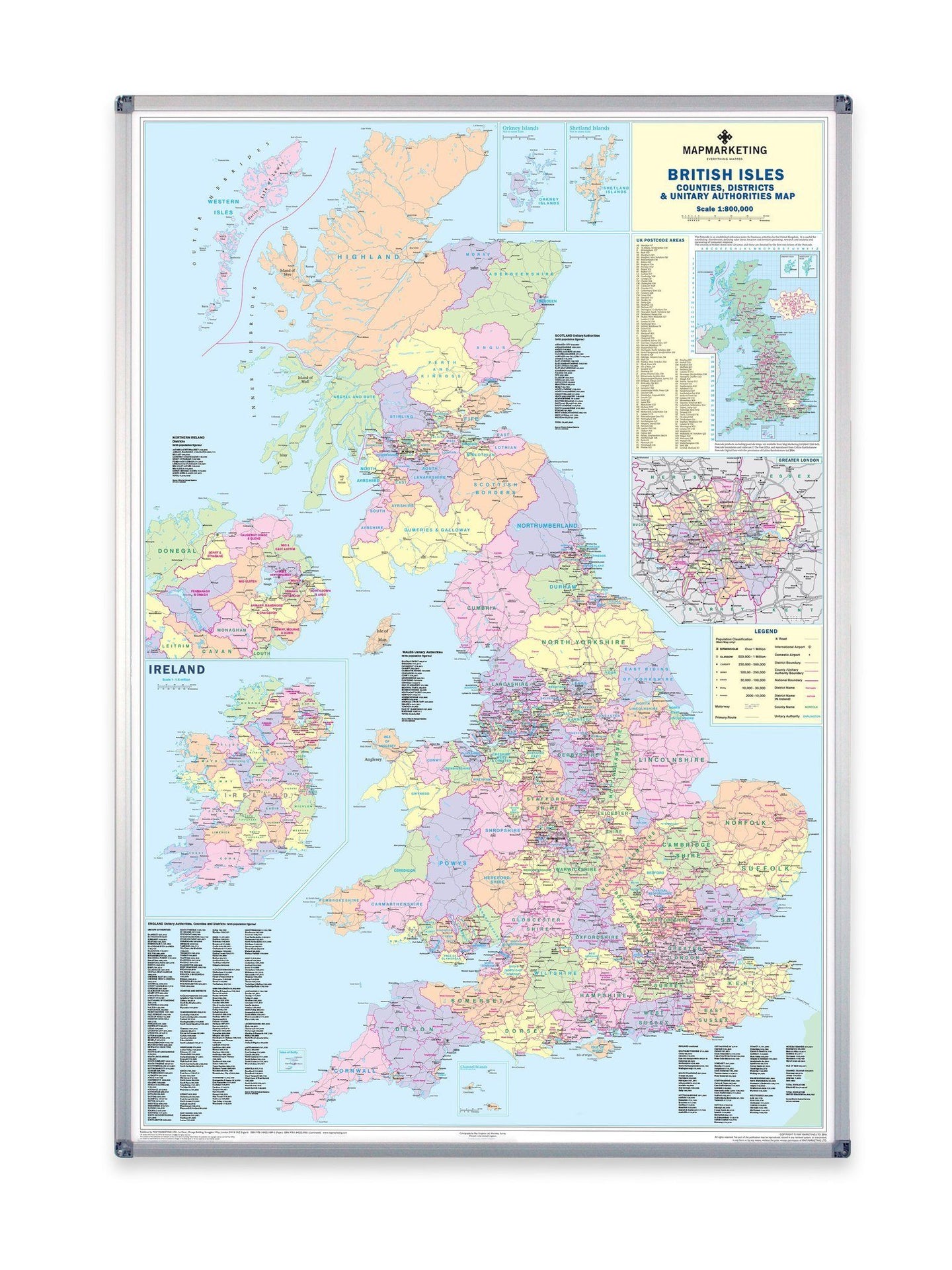
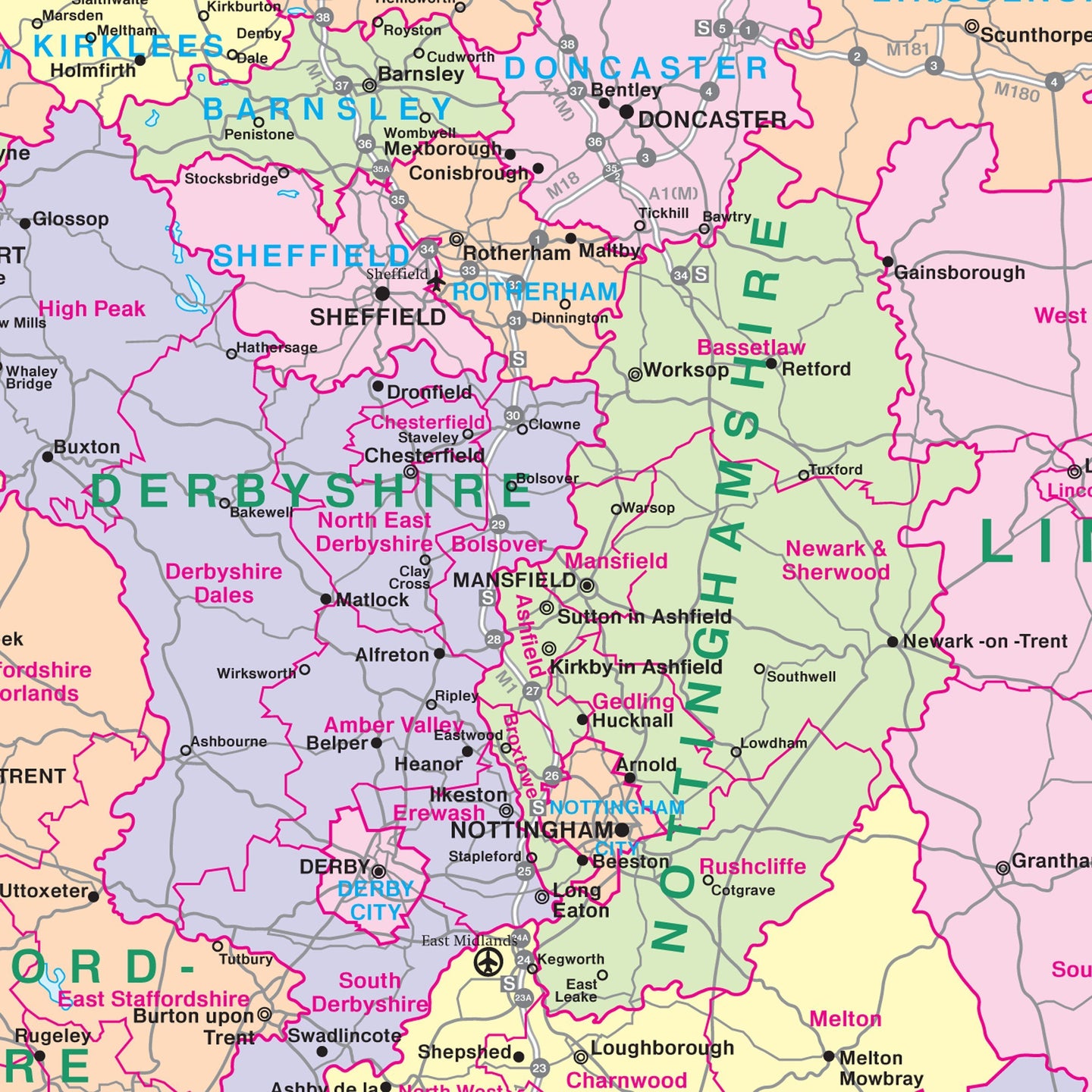
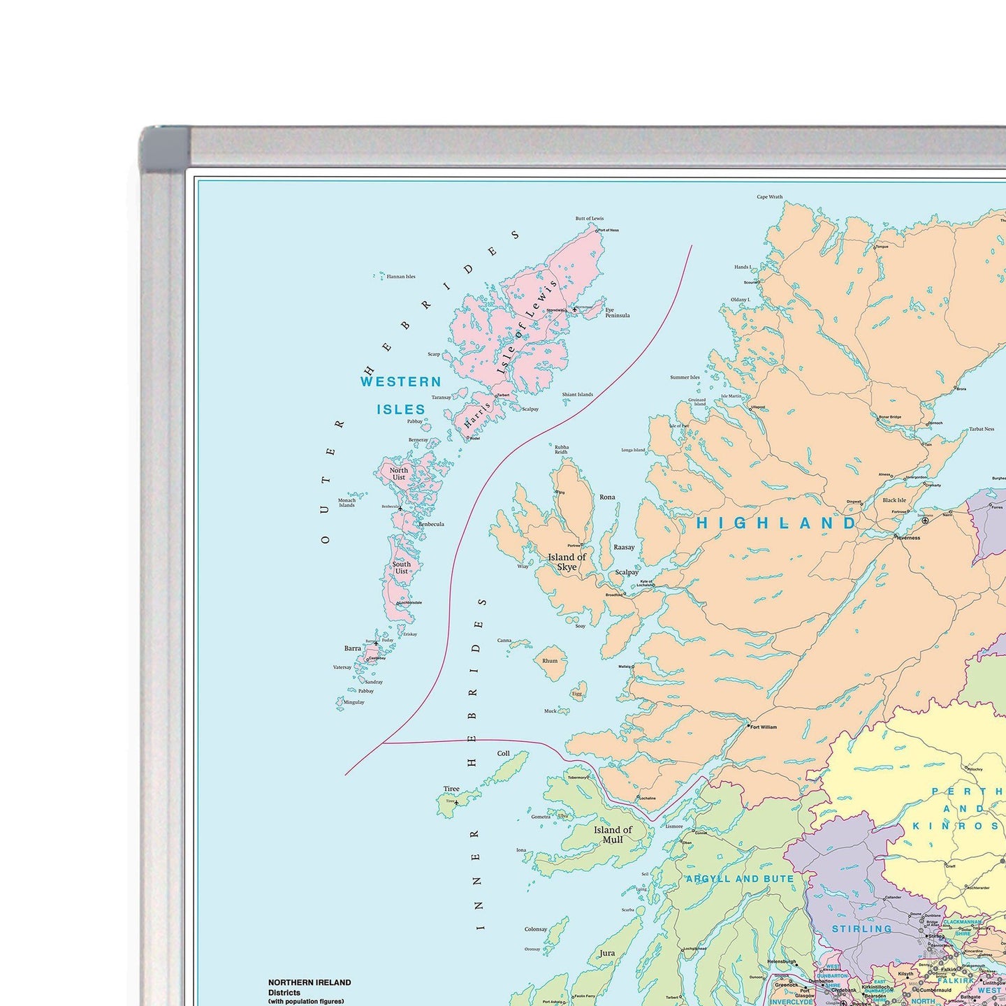
A large UK wall map showing all the County, District and Unitary Authority boundaries.
The recently published edition of the Counties map reflects the most recent administrative changes. This map shows all the County, District and Unitary Authority boundaries within the United Kingdom. The divisions of each County into its local District Council areas are clearly shown. Each administrative area is shown in a different colour to its neighbours, making it easy to decipher where the boundaries lie. The map base shows motorways and primary roads (with more detailed roads on the London inset) and features seven types of town/city “stamps” based on population ranging from 2,000 to 1,000,000+ inhabitants.
Map insets include a smaller map showing all of the Postcode Area boundaries within the UK, a list of these Areas giving their main postal towns, a map of London indicating borough boundaries and a map of the whole of Ireland (Northern Ireland is also shown in full scale on the main map) with all County boundaries for the Republic. Population figures for all the regions shown on the map are given based on information supplied by the Local Government Commission.
Size: 120 x 174 cm (47 x 68 inches). Scale 1:440 000 (7 miles to 1 inch)
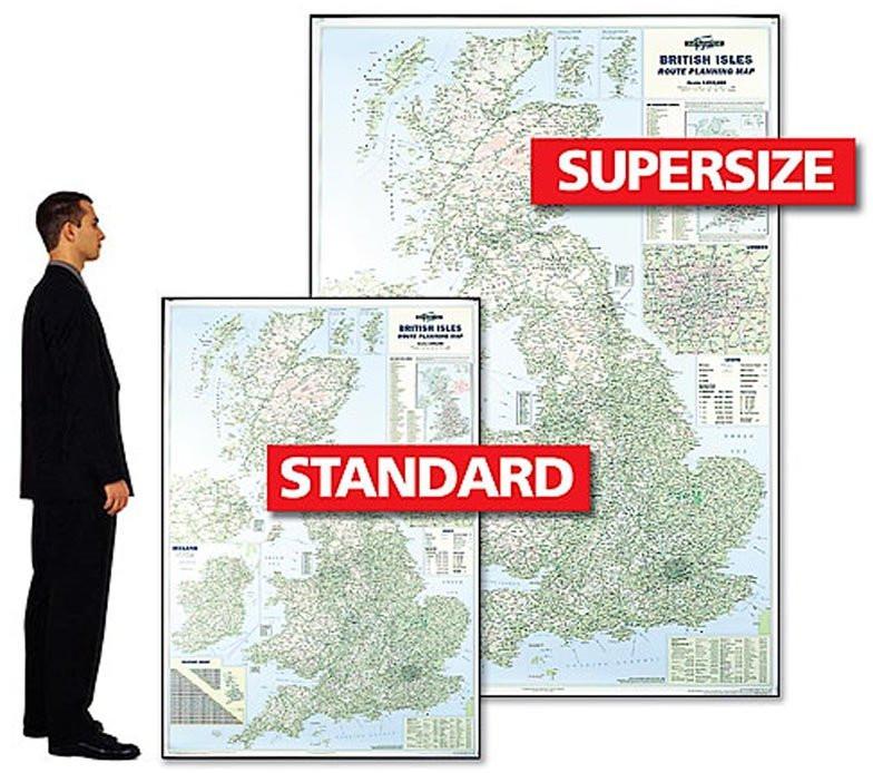
Also available as a Standard size version.
Please note that due to the supersize of this product we are unable to ship overseas
Supersize UK Counties Wall Map

Size: 120 x 174 cm (47 x 68 inches)
Product Code: GBIC
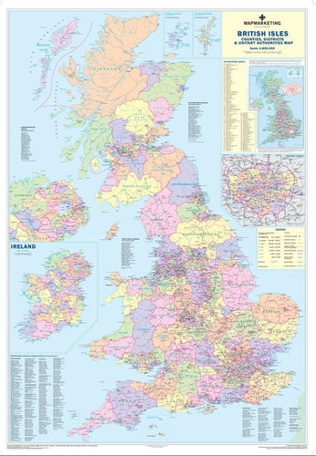
A large UK wall map showing all the County, District and Unitary Authority boundaries.
The recently published edition of the Counties map reflects the most recent administrative changes. This map shows all the County, District and Unitary Authority boundaries within the United Kingdom. The divisions of each County into its local District Council areas are clearly shown. Each administrative area is shown in a different colour to its neighbours, making it easy to decipher where the boundaries lie. The map base shows motorways and primary roads (with more detailed roads on the London inset) and features seven types of town/city “stamps” based on population ranging from 2,000 to 1,000,000+ inhabitants.
Map insets include a smaller map showing all of the Postcode Area boundaries within the UK, a list of these Areas giving their main postal towns, a map of London indicating borough boundaries and a map of the whole of Ireland (Northern Ireland is also shown in full scale on the main map) with all County boundaries for the Republic. Population figures for all the regions shown on the map are given based on information supplied by the Local Government Commission.
Size: 120 x 174 cm (47 x 68 inches). Scale 1:440 000 (7 miles to 1 inch)
Also available as a Standard size version.
Please note that due to the supersize of this product we are unable to ship overseas
REVIEWS