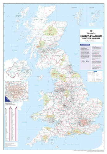
Giant UK Postcode Area & County Boundaries Wall Map
Designed for large-scale business planning and regional analysis, this giant-format wall map covers the entire UK with exceptional clarity. It features both Postcode Area boundaries and the most up-to-date County and Unitary Authority boundaries, all presented on one expansive and easy-to-read map.
Key Features:
- Postcode Area boundaries are clearly outlined in red, with area letters prominently displayed.
- County and Unitary Authority boundaries are shown in dark green for quick reference.
- A clean black-and-white base map, with National Parks highlighted in pale green.
- Includes motorways, primary roads, and ‘A’ roads in London.
- Seven categories of town and city markers, scaled by population (from 2,000 to over 1 million).
- A detailed inset of Greater London (at a scale of 1 inch to 4 miles) provides enhanced visibility of the dense postcode structure within the M25.
Also included is a comprehensive index of all 124 UK Postcode Areas, listing each area's main postal town or city. A helpful guide explains the structure of UK postcodes, covering Area, District, and Sector levels.
Updated Annually
This map is revised and reprinted each year to ensure you receive the most current boundary data available.
Specifications:
-
Size: 120 x 83 cm (47 x 33 inches)
-
Scale: 1:850,000 (13.4 miles to 1 inch, 8.5 km to 1 cm)