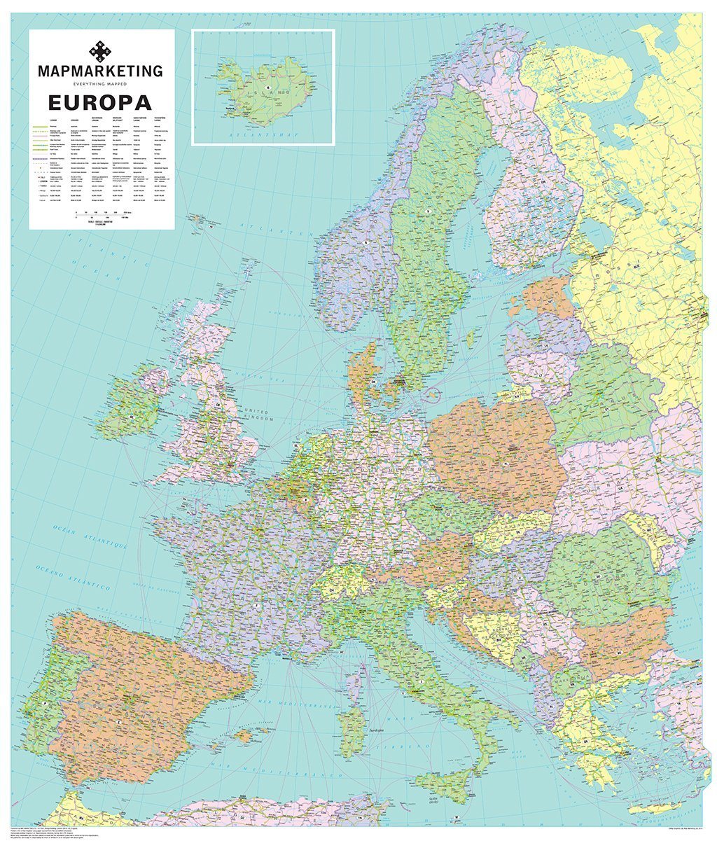


The 'Europa' Political Wall Map of Europe includes the latest road network data available as well as bringing the country boundaries bang up to date.
This detailed European wall map covers the whole of the continent of Europe, going east as far as Moscow and south to North Africa. Each country is shown in a different colour from its neighbours, and the country names are given in the native language of that country (for example Deutschland and Espana rather than Germany and Spain). The cities are also in this format, with English translations where necessary (for example Praha/Prague).
A full legend is given in six languages (English, French, German, Finnish, Norwegian and Swedish) showing motorways and principal roads, towns and cities (with population indicated in six different population bands). International airports and ferry routes are also shown. Iceland is shown in an inset at the same scale.
- Size: 109 x 93 cm.
- Scale: 1:4 000 000 (63 miles : 1 inch)
This map is permanently bonded between two sheets of tough, flexible, crystal-clear plastic. This finish allows you to “write on, wipe off” with dry or wet wipe pens. This map is also available laminated and framed in either superb satin-finish aluminium or light, black or dark wood supplied ready to display.
Europa Political Wall Map of Europe

Size: 109 x 93 cm.
Product Code: EUR
The 'Europa' Political Wall Map of Europe includes the latest road network data available as well as bringing the country boundaries bang up to date.
This detailed European wall map covers the whole of the continent of Europe, going east as far as Moscow and south to North Africa. Each country is shown in a different colour from its neighbours, and the country names are given in the native language of that country (for example Deutschland and Espana rather than Germany and Spain). The cities are also in this format, with English translations where necessary (for example Praha/Prague).
A full legend is given in six languages (English, French, German, Finnish, Norwegian and Swedish) showing motorways and principal roads, towns and cities (with population indicated in six different population bands). International airports and ferry routes are also shown. Iceland is shown in an inset at the same scale.
- Size: 109 x 93 cm.
- Scale: 1:4 000 000 (63 miles : 1 inch)
This map is permanently bonded between two sheets of tough, flexible, crystal-clear plastic. This finish allows you to “write on, wipe off” with dry or wet wipe pens. This map is also available laminated and framed in either superb satin-finish aluminium or light, black or dark wood supplied ready to display.
REVIEWS