Bespoke Maps: Additional Features
Postcode Boundaries
By adding postcode boundary information to your chosen map base you can transform a simple map into a crucial planning tool. We can overlay postcode boundary information at Area, District or Sector level detail onto your map for no extra cost. See a comprehensive breakdown of how the postcode system works and how you can use it to your needs.
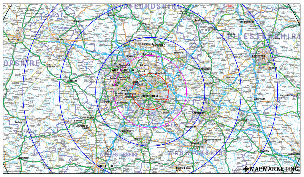
Radial Circles
Why not add radials to your map? These are ideal for displaying delivery zones and catchment areas or mileage and distance indicators. Any number of radial circles can be added to any number of selected centre points to show any distance - you can even chose the colour of the circles! (Examples: Map Marketing’s GB Planners base with radial circles, Bartholomew’s GB Routes & Counties Map base with numbered radials and Bartholomew’s GB Routes & Counties Map base with radials, custom text and Postcode Districts)
Company Logos
We can easily and affordably insert your company’s logo onto any of our custom maps. As well as adding an extra layer of personalisation to your map, having your logo prominently displayed on the map will help to reinforce your corporate brand and raise the company’s profile.
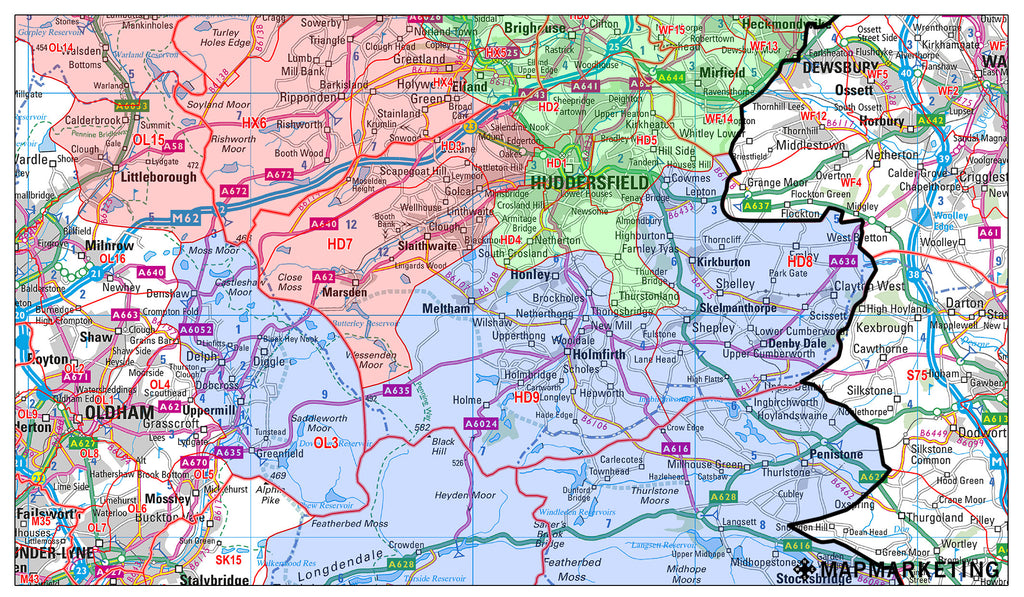
Area Masking
Emphasise your area of interest (perhaps a sales territory or delivery area) by adding masking or a coloured border to your chosen zone. By selecting groups of, for example, Postcodes or Counties we can clearly identify certain sections of the map. The styles and colours available are almost limitless - you decide! (Examples: Bartholomew’s GB Routes & Counties base with masking by Postcode District and Map Marketing’s Planners base with masking by Unitary Authority)
Custom Text
We can add any text you require to your map. Labels and annotations can help to really bring your map to life, why not add your contact details or label branches or depots for example? (Examples: Bartholomew's Greater London base with customised text and Map Marketing's Planners base with custom text)
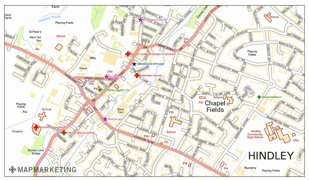
Symbols and Markers
Symbols or markers can be added to your map to identify or highlight stores or branches or maybe to pinpoint target areas. A wide range of styles, colours and sizes are available. (Examples: Map Marketing's Planners base with location markers and logos, Bartholomew's GB base with location markers and Bartholomew’s Greater London Street Level base with location markers)
Administrative Boundaries
The following layers of administrative boundaries can be added to your map for no extra charge. Currently available boundaries include:
- County
- Unitary Authority
- District
- London Borough
- Ward
- Parliamentary Constituency
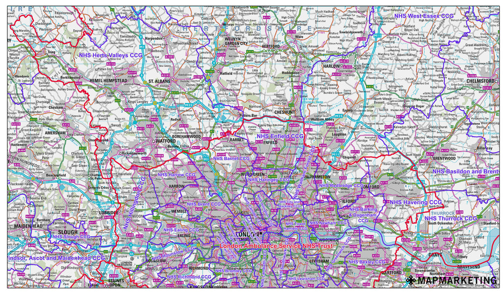
Health Boundaries
The following layers of health boundary information can now be added for free to your chosen map base (Example: Bartholomew’s GB Routes & Counties Map base with CCG & hospital information overlaid):
- Clinical Commissioning Groups
- Hospitals
- NHS Clusters